Trail Other activity Stadt Bregenz - bregenz - Pfänder b - Photo
 gust
gust

User

© OpenStreetMap contributors
Length
Length
4.4 km
Max alt
Max alt
1028 m
Uphill gradient
Uphill gradient
627 m
Km-Effort
Km-Effort  
10.6 km
Min alt
Min alt
397 m
Downhill gradient
Downhill gradient
0 m
Boucle
Boucle
No
Creation date :
2014-12-11 00:00:00.0
Updated on :
2014-12-11 00:00:00.0

(0 Reviews)

Other activity
Other activity
--
Difficulty : Unknown

Scan this QR Code to open this trail in the SityTrail application

FREE GPS app for hiking

Logo SityTrail SityTrail

IGN / Geographical institutes

Download SityTrail from the App Store Download SityTrail from Google Play

Logo SityTrail SityTrail World

The world is yours!

Download SityTrail from the App Store Download SityTrail from Google Play Download SityTrail on Huawei AppGallery

About

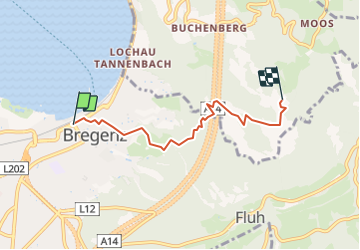
Trail Other activity of 4.4 km to be discovered at Vorarlberg, Bezirk Bregenz, Stadt Bregenz. This trail is proposed by gust.

Description

von Rorschach nach Heiden mit der Rorschach - Heiden - Bahn

Elevation profile

Positioning

Country:
Austria
Region :
Vorarlberg
Department/Province :
Bezirk Bregenz
Municipality :
Stadt Bregenz
Location:
Unknown
Start:(UTM)
555996 ; 5261411 (32T) N.

Trails nearby

Trail Hybrid bike Stadt Bregenz - Bregenz – Kreuzlingen - Photo
Hybrid bike
norihtom

Hybrid bike

Very easy
Stadt Bregenz, Vorarlberg, Bezirk Bregenz, Austria
72 km | 79 km-effort
Unknown
No
Trail Cycle Stadt Bregenz - f-oostenrijk-bodensee-omronding - Photo
Cycle
gpstracks

Cycle

Very easy
Stadt Bregenz, Vorarlberg, Bezirk Bregenz, Austria
197 km | 223 km-effort
Unknown
Yes
Trail Other activity Stadt Bregenz - Bregenz - Pfänder - Photo
Other activity
gust

Other activity

Very easy
Stadt Bregenz, Vorarlberg, Bezirk Bregenz, Austria
4.2 km | 10.5 km-effort
Unknown
No


Close
My subscriptions